Photos of Free State - a former Boer Republic, South Africa

Free State - a former Boer Republic
The Orange Free State was founded in 1854 as an independent Boer republic (Oranje Vrijstaat) under British suzerainty between the Orange and Vaal rivers. The British determined the borders in 1848 when it was proclaimed the Orange River Sovereignty or Transorangia, with a British resident in Bloemfontein. It had been a farm, bought from a Griqua farmer and became the capital. The eastern border was called the Warden line, the boundary with the Basuto (Sotho) reserve that King Moshoeshoe I had been forced to accept; this is now the border with Lesotho.
you may then send it as a postcard if you wish.
On 23 February 1854, the British commissioner and the Boer representatives signed the Orange River Convention, recognising the independence of the Orange Free State. However, most whites in the region would have preferred British rule. It was, however, politically and economically successful, but as a result of the Second Anglo-Boer War, it was annexed by the British in 1900 as the Orange River Colony. Two years later, at the end of the Boer War, the British abolished its independence, and it was directly run by the British until 1907, when it obtained self-government. In 1910 it joined the Union of South Africa as the Orange Free State province.
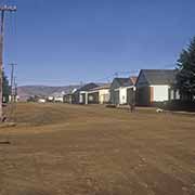
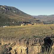
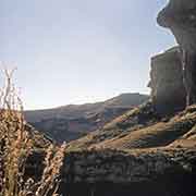
Two small areas within the province were set up as Bantu “homelands” during the Apartheid days: one was a small region of only 655 km² in the east, on the northern border with Lesotho. It was named QwaQwa; actually, a San (Bushmen) name pronounced with two clicks, meaning “whiter than white”, referring to white rock formations or frequent snow on the Drakensberg mountains. It was designated for more than 180,000 Sotho-speaking people and received self-government in 1974. Seventy kilometres east of Bloemfontein is the town of Thaba ‘Nchu (‘Blue Mountain’), settled in 1833 by Barolong clans, a Tswana people. It became part of the area set aside for the Bantustan of Bophuthatswana, far to its north. These two areas were reabsorbed into South Africa in 1994.
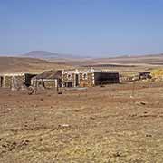
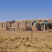
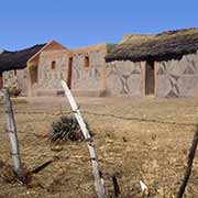
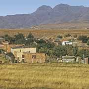
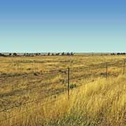
The Free State is mainly rural, with large maise farms and grazing lands for sheep. It has a relatively large white population: almost 13% speak Afrikaans. The African people are mainly Sotho: 64% of the population speak Sesotho. The capital is Bloemfontein (‘Fountain of flowers’ in Afrikaans) and is also South Africa’s judicial capital.